Description
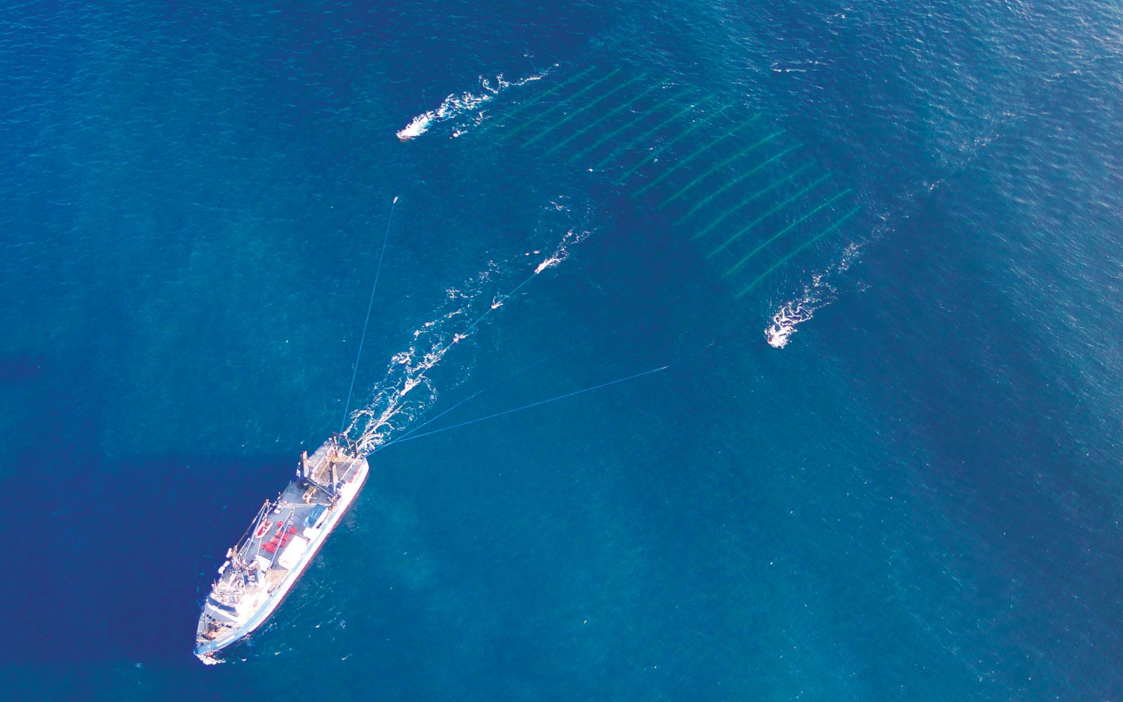
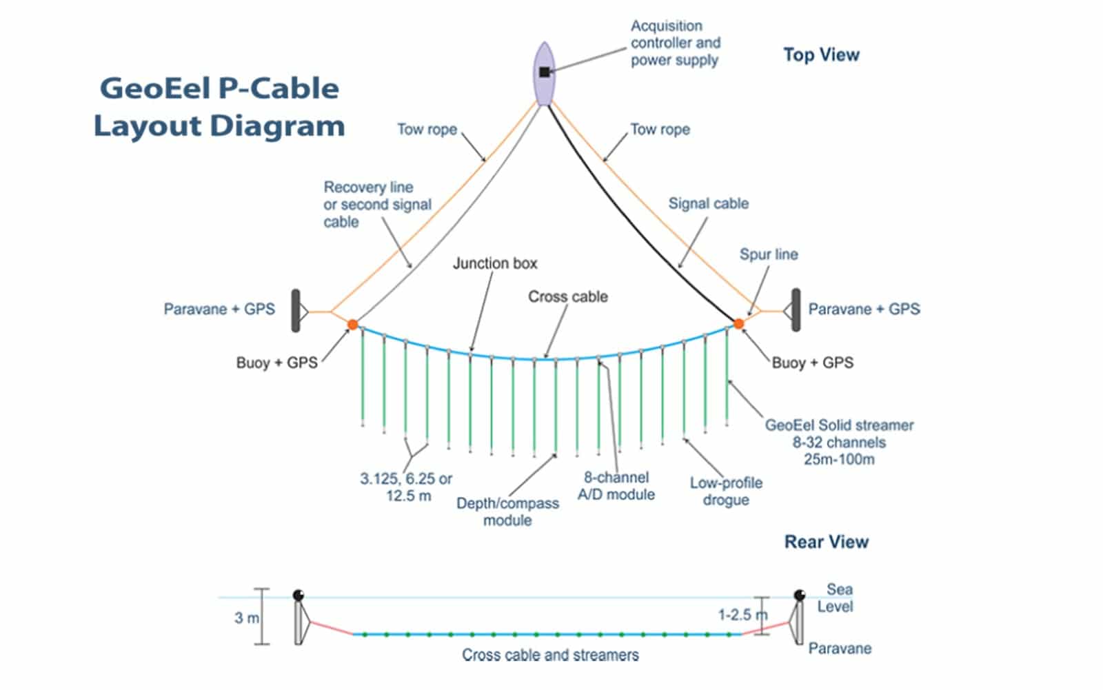
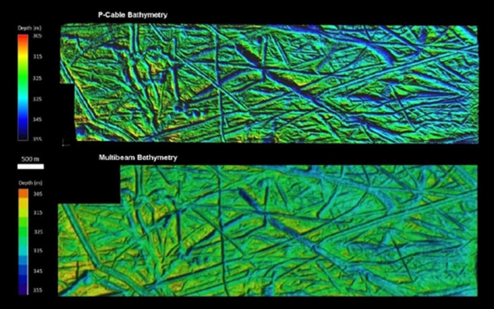
Geometrics is leading and transforming the future of marine HR3D with the revolutionary P-Cable system. Based on our tried-and-true GeoEel technology, the P-Cable is an innovative platform for towing up to 24 short streamers from small vessels of opportunity with minimal crew. For marginally more cost than a conventional 2D high-resolution seismic survey, you can have true 3D data with all the attendant advantages -- better imaging of more complex structures, less directional bias, full 3D migration and better preservation of high frequencies. The resulting data are simply amazing and the resolution unprecedented.
But don't take our word for it, see the P-Cable difference.
General Specifications:
- GeoEel Solid Active sections
- Number of streamers: 6 – 24
- Streamer length: 25 – 100m
- Channels per streamer: 8 – 32
- Streamer separation: 3.125, 6.25 and 12.5m
- Group interval: 1.5625 (GeoEel liquid), 3.125, 6.25 and 12.5m
- Data recording: PC-based Geometrics CNT-2 marine controller
- Paravanes: Baro #3 or equivalent*
- Streamer handling: Two small winches for paravanes, two medium winches for cross-cable and digital signal cable, storage drum recommended for active sections
CNT-2 Seismic Acquisition Controller
Powered by the CNT-2 Seismic Acquisition Controller. The CNT-2 is a system control capable of changing the sample interval, gain settings, and more. It has a full survey log, which keeps track of changes in acquisition parameters, where each file was written along with the date and time, alarms or error messages that have occurred during the survey, time-stamped observer comments, etc. The CNT-2 system also has the following capabilitites:
- Multi-Drive Writing Capabilities in SEG-2, SEG-Y, or SEG-D
- Fully RAID-compatible
- Full integration of GPS, Depth, Compass, and other serial data into SEG-D
- System Testing
For more details on the CNT-2 Seismic Controller please refer to pages 61 - 181 of the GeoEel/P-Cable Manual.
Features and benefits
- Small and light: 5-ton bollard pull*: Deployable from small vessels of opportunity
- Simple: minimal in-water assets: Highly robust, easily and rapidly deployed with minimal crew
- True 3D coverage, full 3D migration: Better resolution of more complicated geometries
- Bin size as small as 3.125m: Higher resolution than previously possible
- Array width up to 300m: Rapid production, up to 50 km2/day at 5 knots (6.125m bins)
- Allows overlap between sail lines: Minimal infill required
- Based on true solid streamer technology: Bulge wave immunity, virtually no strumming noise; environmentally friendly
- Convertible to full-featured 2D system: Allows large-offset 2D survey for velocity determination if necessary
Downloads
TYPICAL USES
- Oil and Gas Exploration
- Coastal Rehabilitation
- Seismic Risk Assessment
- Methane Hydrate Investigation
- Marine Geologic Mapping


